When resources become frontlines in northeast Syria
Oil, water, and wheat no longer flow as public goods, but as leverage in a prolonged war economy.


شارك على
 مسنجر
مسنجر
 واتساب
 ثريدز
ثريدز
 بريد إلكتروني
 الطباعة
شارك على


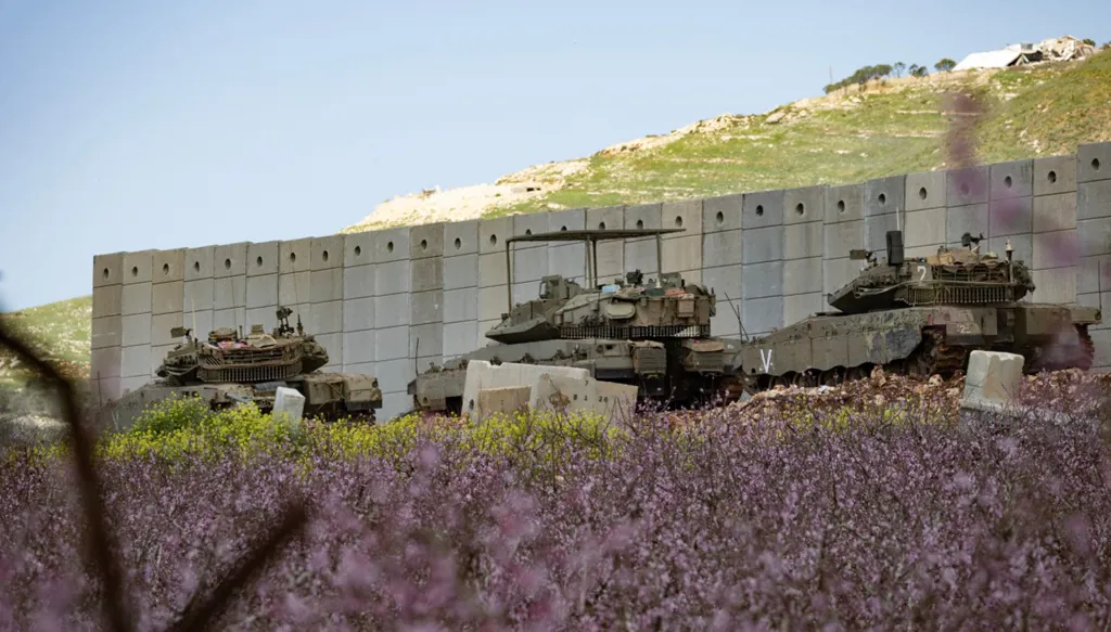
At the heart of Syria’s renewed struggle over power, borders, and resources, the northeast stands out almost all the territory east of the Euphrates River as a “reservoir” that no government in Damascus can afford to ignore. This area is not merely a geography with a strong Kurdish presence, but a nexus of resources: oil and gas that can be converted into liquid revenue, a basket of grain and cotton that once formed the backbone of Syria’s food security, trade corridors and border crossings, as well as the waters of the Euphrates on which irrigation and electricity depend.
For this reason, control of the region between 2011 and 2024 was not simply a military matter, but a full war economy: whoever controls the fields, silos, and dams holds the ability to finance administration and fighting, distribute bread and fuel, and thus buy loyalties or impose them.
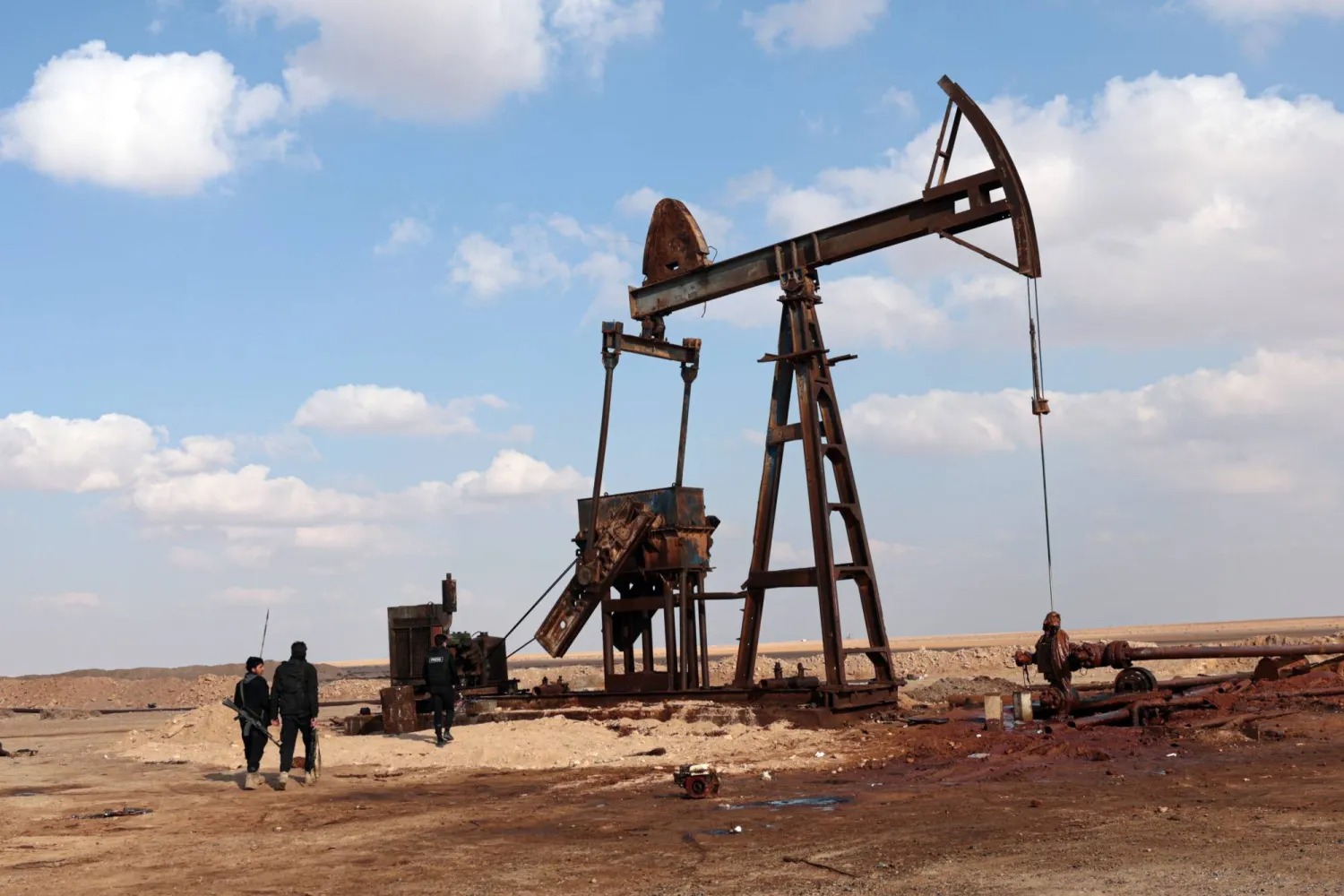
Before the war, Syrian oil was produced at levels close to 383,000 to 400,000 barrels per day, with the major fields in the east, particularly in Deir ez-Zor, serving as one of the state’s main sources of hard currency. As central control fragmented, oil shifted from being “state revenue” to “conflict rent”: it fell under successive controlling actors, infrastructure was destroyed or neglected, and crude refining and smuggling practices spread. The result is that the largest fields no longer resemble what they once were. Production at the al-Omar field, historically said to have reached around 50,000 barrels per day, has in some recent estimates fallen to only a few thousand due to lack of investment and worn-out equipment. In other words, resources were not lost only because control changed, but because the very capacity to extract them declined, a long-term effect that may outweigh the consequences of battles that redraw maps.
Gas was also part of the energy equation, especially at strategic sites such as the Conoco facility in the Deir ez-Zor countryside. But the war, followed by sanctions and the fragility of the national electricity grid, made gas less translatable into a public benefit and more closely tied to whoever controls processing and protection points. In such an environment, every energy site becomes a “site of sovereignty” as much as an economic one: whoever controls it can use it to bargain over electricity, fuel, and salaries.
Agriculture, meanwhile, is the northeast’s most impactful wealth in the daily lives of Syrians. In 2011, the Jazira region produced about 2.15 million tons of wheat, roughly 55 percent of Syria’s total output, and around 523,000 tons of cotton, nearly 78 percent of the national total. War, however, reversed the equation. Irrigation networks and silos were destroyed, labor was displaced, financing, seeds, and diesel became scarce, and then waves of drought and heat further strained the food basket. When agriculture declines, the result is not only food shortages, but the expansion of a “politicized wheat” market: a struggle over who buys the crop, at what price, for whose authority, and whoever controls the storage silos holds the “decision over bread.”
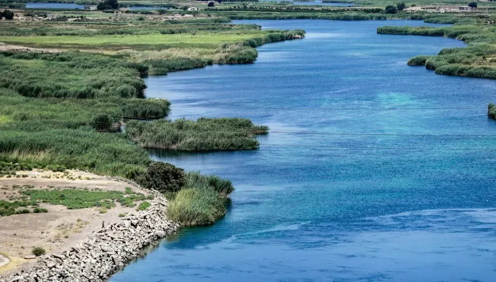
All these resources intersect with an element no less dangerous: water. The future of agriculture and electricity east of the Euphrates is tied to the river’s incoming flows from Turkey, where the Southeastern Anatolia Project known by its Turkish acronym GAP includes 22 dams, 19 hydroelectric power plants, and extensive irrigation plans with figures cited as high as 1.8 million hectares. Here, the Syrian conflict becomes part of a wider geography: the resources of geographic Kurdistan stretching across Syria, Turkey, Iraq, and Iran, where oil, gas, water, and borders intersect with chronic sovereignty disputes.
In Iraq, the picture appears clearer in numerical terms. The Kurdistan Regional Government is estimated to manage around 45 billion barrels of reserves, but international bodies such as the US Energy Information Administration note that these figures may include unproven resources and disputed areas, while other estimates reduce the resources in areas actually under control to only a few billion barrels. Oil nevertheless remains the backbone of the region’s political economy. Indeed, the halt of its exports through Turkey between 2023 and 2025 cost the region, according to Kurdish leaders’ statements, losses amounting to tens of billions of dollars, illustrating how a political and legal dispute can disrupt a resource that is assumed to be guaranteed.
In Turkey, a dual paradox stands out. The country’s Kurdish southeast is a reservoir of water and dams that gives Ankara regional leverage over Syria and Iraq, and it is also a growing source of domestic oil production, such as the Gabar Basin in Şırnak Province in southeastern Turkey, where recent discoveries have been promoted as part of efforts to expand local oil output, with ambitious estimates for some fields. Yet the state’s conflict with the Kurdistan Workers’ Party has made development and resources part of a fundamentally security-driven equation. In Iran, public figures on the western Kurdish regions are less clear, but the pattern of “development under the pressure of sanctions and security” renders resources there less transparent and more subject to the logic of the center and its boundaries.
The overall conclusion is that the resources of northeast Syria are not merely local “spoils,” but a link in a broader chain known as geographic Kurdistan: oil that can be monetized but has been eroded by war, agriculture that underpins food security yet is hostage to water and politics, and corridors and borders that, in times of conflict, are turned into informal taxation. Between 2011 and 2024, the war did not only change the map of control; it changed the actual value of the resources themselves and redefined them, from national wealth to a conflict economy, and from regular production to a degraded capacity that requires years, investment, and governance to regain the meaning of a “resource” rather than that of “rent.”

العلامات الدالة
الأكثر قراءة
خلف صورة القوة الاقتصادية والنفوذ العالمي، تخوض أكبر اقتصادات العالم معركة أخرى صامتة: سباق الاقتراض، حيث باتت الديون تتضخم بوتيرة تقترب من حجم الاقتصاد العالمي نفسه.