
Controversy over southern Lebanon villages on Apple Maps amid ongoing conflict


 Messenger
 Whatsapp
 Threads
 Email
Email
 Print
Print
 X
X
 Facebook


Amid the war in Lebanon and the ongoing clashes in the south, the repercussions of the escalation have not been limited to the ground, but have also extended into the digital space, where the Apple Maps application has sparked widespread controversy after users noticed the absence or difficulty in finding the names of several southern villages. Between accusations and explanations, the need has emerged for a careful reading of this issue in light of the latest developments.
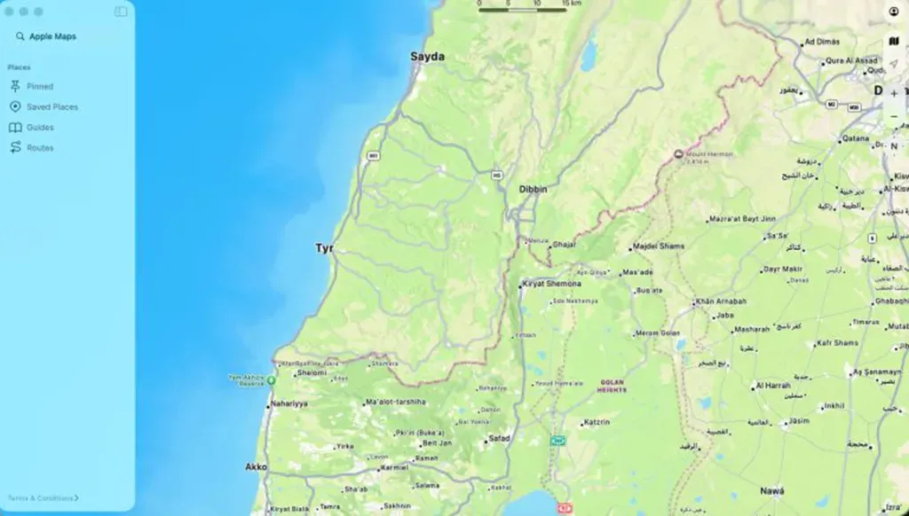
The controversy escalated after users on social media circulated images showing the absence of labels for border towns such as Bint Jbeil, Aitaroun, and Maroun al Ras, especially when compared with the Google Maps application, where these areas appear with clear names and at wider zoom levels. This discrepancy led some to reinforce the assumption that these villages had been removed from Apple’s maps in the context of the ongoing war.
So you’re telling me a $3,200,000,000,000 company cannot place verified and known town names in southern Lebanon?
— Ethan Levins 🇺🇸 (@EthanLevins2) April 12, 2026
They purposely are erasing Lebanon’s history. They can add these towns in 5 minutes. pic.twitter.com/ye65mZJcFl
However, Apple clearly denied this claim in a statement to WIRED Middle East, confirming that the villages and towns in question “have not been removed” from its application, but rather “were not originally listed” as named towns or villages on the platform. Accordingly, what was interpreted as a “removal” is in fact a prior absence of labeling, not the result of a recent decision linked to the ongoing events. The report also stressed that the absence of a name or the difficulty in finding it does not necessarily mean that the place has been removed from the map.
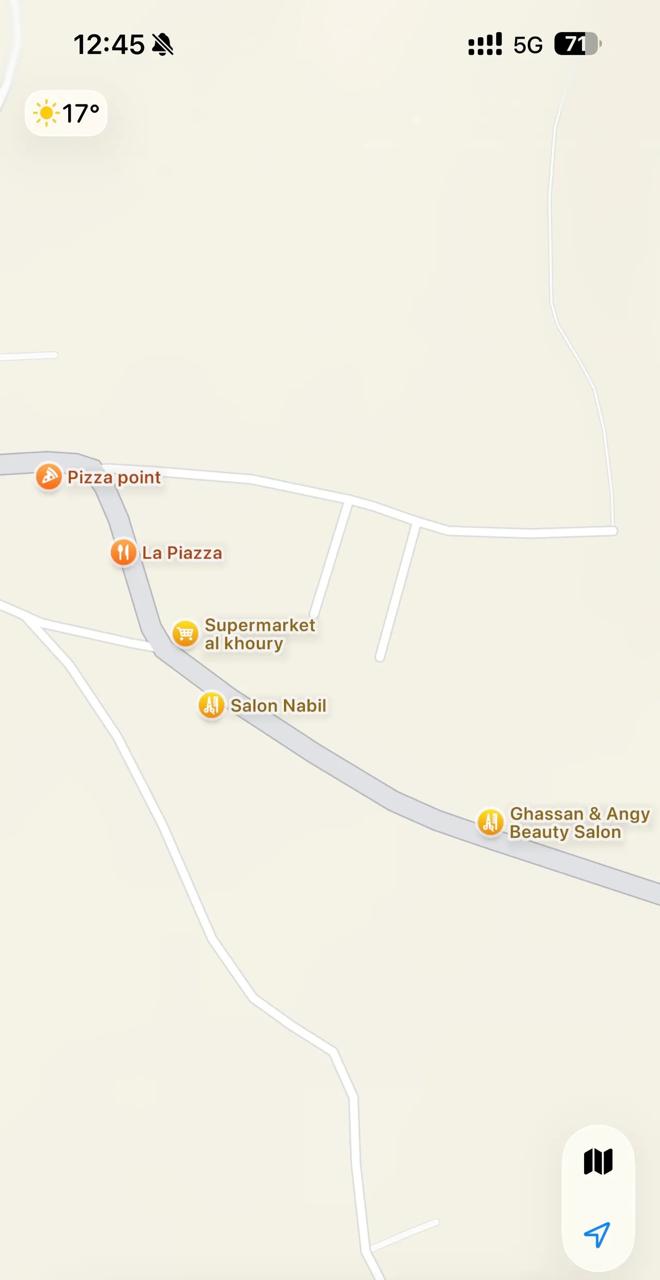
Practically, the application shows partial details in these areas such as roads, institutions, and points of interest (restaurants, shops, salons, etc.), while the names of the towns themselves remain less prominent or not visible, even at advanced zoom levels. In some cases, street names or businesses appear before the name of the town itself, which reinforces the impression among users that there is an absence.
Technical information indicates that Apple Maps relies on staggered geographic rollout phases, meaning that the latest and most detailed version of the service has not yet been released in this region. This means that the level of coverage and detail there is still limited compared to other areas, which explains the clear difference when compared with other platforms.
This controversy arises in a highly sensitive context, as it coincides with the ongoing Israeli occupation of parts of southern Lebanon, and with escalating strikes and evacuation warnings, which have led to widespread displacement. Estimates indicate that around 1.3 million people have been forced to leave their homes under difficult humanitarian conditions, making the question of the digital “presence” of these areas even more sensitive due to its connection to identity and existence.
On the other hand, this discrepancy raises questions, especially since Apple Maps shows detailed labels for cities and towns on the opposite side of the border, including geographically nearby areas. The company has only stated that its latest experience is not available “in this region,” without providing a more precise explanation of the geographic scope or a timeline for expanding coverage.
In conclusion, the data does not indicate any deliberate removal or omission of the names of southern villages from Apple Maps, but rather a gap in coverage and labeling resulting from the nature of service development and uneven geographic rollout.
However, this controversy reveals the sensitivity of digital geographic representation in conflict contexts, where the absence of a label, even if technical, can be interpreted by users as an actual absence.